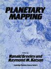
Planetary Mapping行星绘图
出版时间:2007-2 出版社:Cambridge University Press 作者:Greeley, Ronald; Batson, Raymond M.; 页数:296
内容概要
Planetary Mapping describes the history and process of mapping planets and satellites beyond the Earth. Mapping planetary bodies is a unique process much different from ordinary terrestrial cartography. The book begins with an introduction to the differences between terrestrial and planetary mapping and continues with a general discussion of the history of planetary mapping. The fundamentals of cartographic techniques are described in detail, and appendixes on map formats and projects, halftone processes for planetary maps, and available mission data are also included. The general language used in this book will make it accessible to researchers and students in planetary science as well as cartographers, photogrammetrists, geodesists, geologists, and geophysicists. Planetary Mapping describes the history and process of mapping planets and satellites beyond the Earth. Mapping planetary bodies is a unique process much different from ordinary terrestrial cartography. Although many kinds of imaging systems have been launched into interplanetary space, nearly all of them were designed for purposes other than map-making.
书籍目录
PrefaceList of Contributors1 Introduction 1.1. Planetary versus terrestrial mapping 1.2. Data for making planetary maps 1.3. Topographic maps and geodetic control of planetary surfaces 1.4. Summary2 History of planetary cartography 2.1. Lunar and planetary mapping from the Earth 2.2. Lunar and planetary mapping from spacecraft data 2.3. Summary 2.4. Refcrences3 Cartography 3.1. Map design 3.2. The mapping process: paper maps 3.3. The mapping process: digital maps 3.4. Mapping the small, irregularly shaped satellites and asteroids 3.5. Scope of digital planetary cartography 3.6. Summary 3.7. References4 Planetary nomenclature 4.1. Early nomenclature: pretelcscopic period 4.2. Moon: 1640-1977 4.3. Mars: Mid-seventeenth century to 1976 4.4. IAU task and working group format change-1973 4.5. Mercury: 1974-6 4.6. Between missions, 1976-9 4.7. Venus: 196o-88 4.8. Jovian satellites: 1977-80 4.9. Saturnian satellites: 1980-2 4.1o. Expansion of existing nomenclature: 1981-9 4.11. Uranian satellites: 1984-8 4.12. Neptune's satellites: 1989 4.13. Future plans 4.14. Summary and conclusions 4.15. References5 Geodetic control 5.1. Background 5.2. The coordinate systems 5.3. Analytical phototriangulation 5.4. The control networks 5.5. Future missions and plans 5.6. Summary 5.7. References6 Topographic mapping 6.1 Introduction 6.2. Topographic data types 6.3. Topographic datum 6.4. Secondary control networks 6.5. Map compilation techniques 6.6. Lunar topographic mapping 6.7. Topographic mapping of Mars 6.8. Topographic mapping of Venus 6.9. Topographic mapping of the satellites of Uranus 6.10. Digital topographic maps 6.11. Topographic mapping with data from future planetary missions 6.12. References7 Geologic mapping 7.1. Introduction 7.2. Rationale and general methods……Appendix Ⅰ Map formats and projections used in planetary cartographyAppendix Ⅱ Halftone processes for planetary mapsAppendix Ⅲ Digital planetary cartographyIndex
图书封面
评论、评分、阅读与下载
用户评论 (总计0条)
推荐图书
- 走投無路危險爺爺(08)
- 走投無路危險爺爺(09)
- 走投無路危險爺爺(10)
- 走投無路危險爺爺(11)
- 走投無路危險爺爺(12)
- 走投無路危險爺爺(13)
- 活埋蓝调里
- 尼泊爾史--雪峰之側的古老王國
- 精忠志
- 絵巻水滸伝 梁山豪傑壱百零八 (大型本)
- 我要当最棒的超级英雄
- 雪皇后 The Snow Queen
- 臨死!! 江古田ちゃん 1
- 国家职业资格培训多媒体工具
- 石柱土家族自治县概况
- 琼中黎族苗族自治县概况
- 海北藏族自治州概况
- 巍山彝族回族自治县概况
- 黔东南苗族侗族自治州概况
- 宁蒗彝族自治县概况
- 河口瑶族自治县概况
- 门源回族自治县概况
- 时装设计师
- 电影化装造型 Movies,Makeovers and Huge Surpriese
- 玻璃艺术
相关图书
- Nonlinear differential equations and dynamical systems非线性微分方程和动态系统
- Gravity and the behavior of unicellular organisms重力与单细胞生物体行为
- 開花天使(01)
- 開花天使(02)
- 開花天使(03)
- 開花天使(04)
- 開花天使(05)
- 開花天使(06)
- 開花天使(07)
- 開花天使(08)
- 開花天使(09)
- 開花天使(10)
- 開花天使(11)
- 開花天使(12)
- 開花天使(13)
- 開花天使(14)
- 開花天使(15)
- 開花天使(16)
- 開花天使(17)
- 走投無路危險爺爺(02)
- 走投無路危險爺爺(03)
- 走投無路危險爺爺(04)
- 走投無路危險爺爺(05)
- 走投無路危險爺爺(06)
- 走投無路危險爺爺(07)
